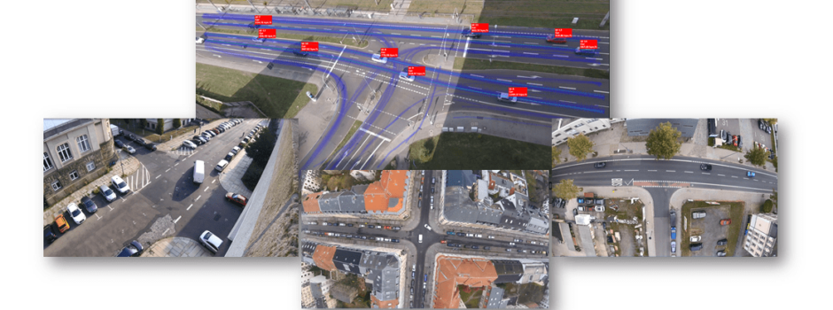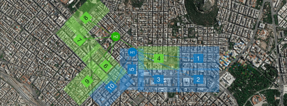
100 busy intersections / 0.5 million of trajectories / covered more than 1.3 km^2 / gathered by 10 drones flying simultaneously. A first-of-its-kind experiment with open results was realized by professor Geroliminis and Emmanouil (Manos) Barmpounakis from EPFL (École polytechnique fédérale de Lausanne), who provided the video data and analyzed by DataFromSky AI (www.datafromsky.com).
A swarm of drones hovered over the central business district of Athens over multiple dates to record traffic streams in congested areas with more than 100 km-lanes of the network. From each video, trajectory data was extracted by the most advanced traffic intelligence DataFromSky and merged into the one traffic scenario with multimodal interactions. 🚗 🚌 🚛 🚲 🏍
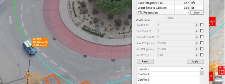
Due to the extreme accuracy of telemetry data about each driver, the dataset is suitable for multimodal traffic research including simulation methods, behavior models, road safety analysis..
💡 Webpage of the project: https://lnkd.in/eyZA3RB
✔️An article about the project: https://bit.ly/2wjvyut has