We are proud to announce that we have connected DataFromSky with a simulation model VISSIM! PTV Vissim is a microscopic multi-modal traffic flow simulation software package developed by PTV Group, first developed in 1992 and nowadays, Vissim is a global market leader in microscopic simulation models! The simulation displays all road users and their interactions in one model.
We have created a promo video demonstrating how to export the results from DataFromSky and use it as an input in Vissim. This possibility opens so many opportunities how to utilize the real data from DataFromSky analysis and how to increase the accuracy of your simulation model!
What kind of data can be exported and what are the plans for further interconnection?
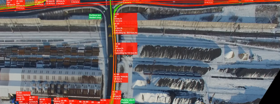
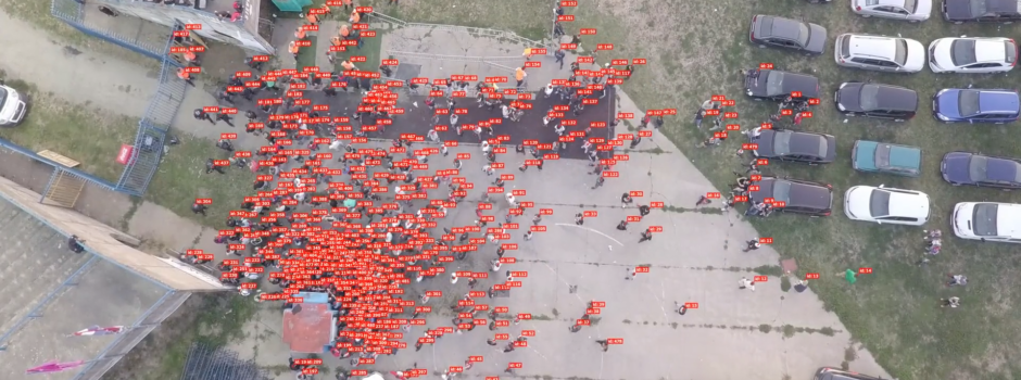
– traffic counts
– vehicle category (number of cars, heavy vehicles, buses, motorcycles etc.)
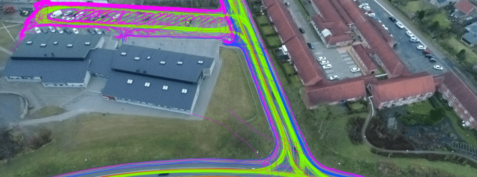
– turning movements – route decisions and routes
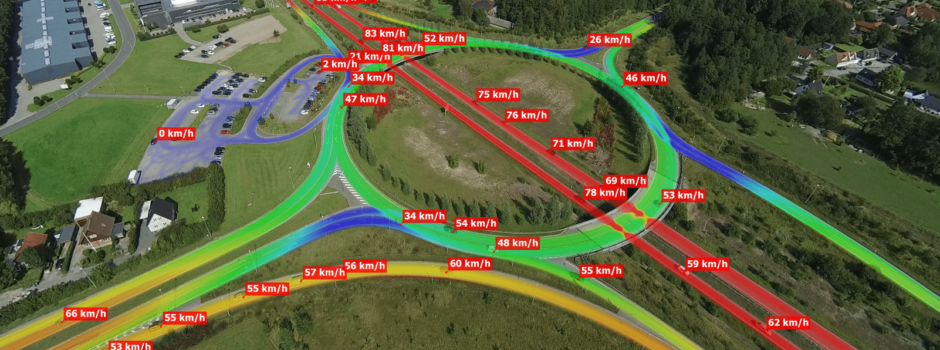
– speeds for model calibration
– accelerations
– travel times (between two defined gates)
– headways between two vehicles following each other (gap in seconds) – advanced gap analysis and headways data provided only by DataFromSky!
– queue lengths (will be added)
The video plays also the role of the very first User manual video of DataFromSky Viewer – it describes the process of creating counting gates in order to export the Origin-destination data and import them into Vissim. Other short instructional videos will follow soon!
Enjoy the video: