We have recently released a new enhanced version of DataFromSky Viewer! You can download the demo package at the home page. The list of differences includes a lot of things, so let’s take a look at few of them.
New feature? Calculate and export headways!
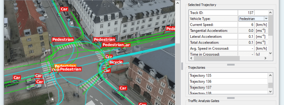
Have a look on the picture below, how to display the headway data in the Viewer. It is important to have the gates set properly per each lane to get the most accurate data. Once you have all the gates defined, choose one gate in the Traffic Analysis Gates box and click on button “Show” in More Statistics option. In a newly opened window, there is possibility to click on Calculate headways. The system will automatically calculate headways for all defined gates in the video. The headway data can be exported to the CSV file, simply by clicking on “Export”.
Movement Dynamics Graph
We have visualized movement dynamics for each trajectory into a graph containing information about the vehicle’s speed and acceleration (total, lateral or tangential). This graph can be created for each selected trajectory.

Some other improvements…
- Start of Video Sequence
- Start of Tracking Log
- Start of Trajectory