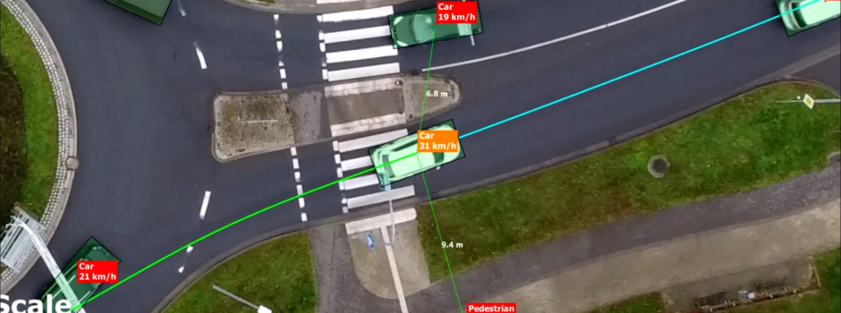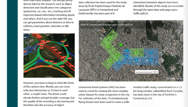
Do you want to cover a wide area and get detailed information about each participant? With DataFromSky and AI it is possible! Read more about challenging projects we have been part of in the Monthly Bulletin of the INSTITUTE OF HIGHWAY ENGINEERS available here 👉https://bit.ly/3arCK6q
You can read more about our studies under following links 👉 https://bit.ly/2XZDq03 and https://bit.ly/2xRYQ4u
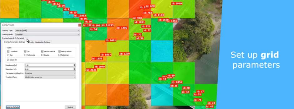
Check capabilities of the DataFromSky Offline services for free and sign up to ai.datafromsky.com. After you sign-up you do get 3 credits that you can use for your own video analysis! The process is easy and fun!
1. Shoot the video from any kind of camera (low positioned camera or drone)
2. Upload it to ai.datafromsky.com and wait for results
3. Download results and do the magic through our DataFromSky Viewer
✔️ Give us feedback! Was it easy and fun? Let’s move to the next stage and contact us regarding your challenging project!