Christmas is just around the corner and we have prepared a special gift for you. An alpha version of our new service DataFromSky Light is now available for all traffic analysis enthusiasts! We have moved closer to the ground to make the awesome features of the DataFromSky closer to you as well. Fully automatic traffic data extraction from various “ground” video sources can be now smoothly and quickly delivered to you using the DataFromSky Light service. Rethink the traffic studies with our free video analytic tools, rethink the way you explore traffic!
The DataFromSky Light is an online service that processes traffic-related video data captured by smartphones, camcorders or highway surveillance cameras. It detects, classifies and tracks traffic objects in any video source. The following traffic object classes are supported:
- pedestrian
- bicycle
- motorcycle
- car
- heavy vehicle
Video and result data exchange is performed via WeTransfer sharing service. How to use the DataFromSky Light service can be seen in the following video:
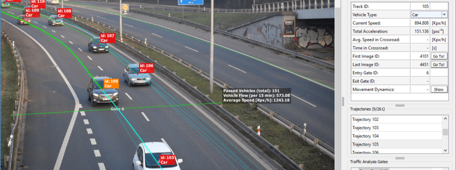
The results of the traffic analysis are provided in our TLGX format and can be viewed using a new lightweight license-free version of the DataFromSky Viewer called DataFromSky Viewer Light. The DataFromSky Viewer Light can visualize the spatial-temporal data that can be interactively examined in the whole analyzed time interval. The DataFromSky Viewer Light has the most of the licensed DataFromSky Viewer version functionality including:
- traffic objects counting
- directional/selective gate counting
- O/D matrix counting
- capacity estimation
- headway statistics computation
- gap time computation
- time to follow computation
- target time computation
- trajectories visualization
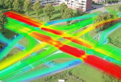
- heat-map visualization
- export of the trajectories in various formats (.csv, .trj, .xlsx)
- snapshot/video render export
The DataFromSky Light can process data from any video input such as static/handheld consumer camera video recording or a video capture from an existing video infrastructure (i.e. surveillance cameras). For the best traffic analysis results we recommend the following input video parameters:
- resolution: 1280×720 or more (min. PAL)
- bitrate: 5 Mb/s or more
- framerate: 25 or more
- min. traffic object size: 32px in one dimension
- continuous video without cuts
- no camera movement
The service can provide accurate results even beyond these parameters. We also recommend minimizing occlusions in the view on the scene in order to maximize the traffic analysis accuracy. For the post process traffic analysis in the DataFromSky Viewer Light software, it is useful for the input video to be as stable as possible with the area of the interest kept in the view throughout the whole video capture process to prevent a misleading gate counting since the video is not georegistered.

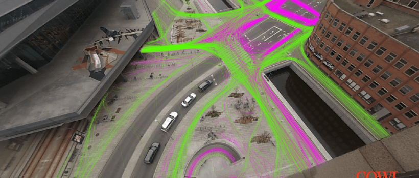
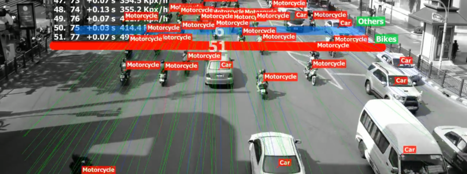
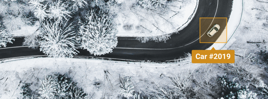
Picture 1: Examples of scene views suitable for the DataFromSky Light.

Picture 2: Not suitable scene views for the DataFromSky Light service (commented from the top left to bottom right – rotated; intended for DataFromSky Aerial; a lot of partial occlusions; big moving objects causing enormous occlusions)
There is no registration needed in order to use the DataFromSky Light. Free usage of the service is limited to 5 videos per day per one e-mail address. The maximum length of 2 hours per video can be analyzed for free as well. For the unlimited DataFromSky Light access please contact info@datafromsky.com. Try and see for free.
Read more