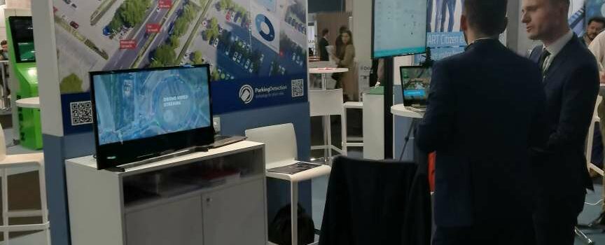
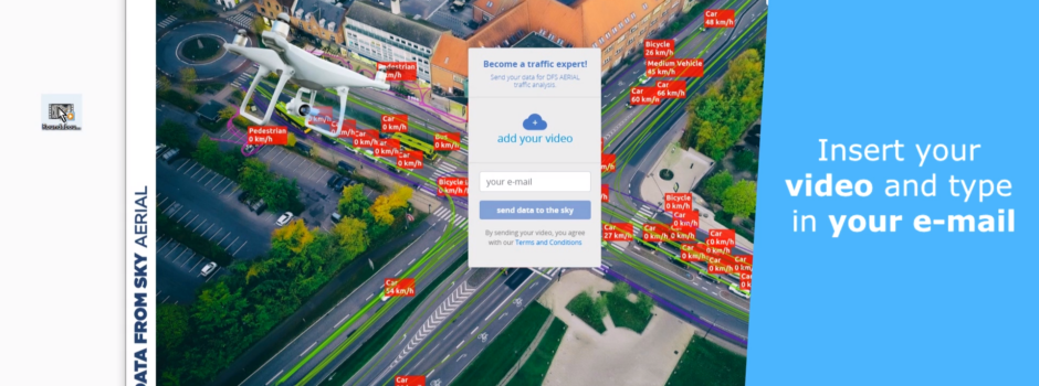
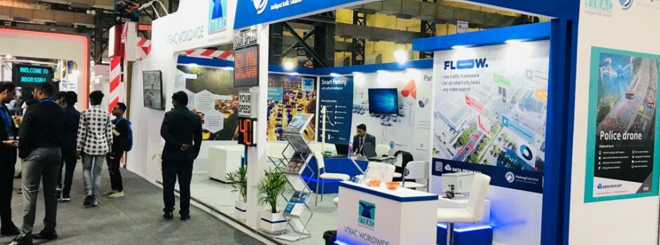
TrafficSurvey – Video post-processing platform

Let's meet!
Intertraffic 2024
16 - 19 April 2024
Amsterdam / Netherlands
Traffex
22 - 23 May 2024
Coventry / England
Let's meet!

New concept of future Berlin streets with DataFromSky Light

How to deal with busy streets in the center of Berlin? Buses, trams, cars, cyclists, pedestrians can be seen everywhere moving without any rules. Is it possible to build car-free, bicycle-friendly & human-oriented city? Macromedia University of Applied Science in Berlin did concentrate on this issue as a part of Master Course Smart City Design and DataFromSky played a key role in the process of analysis of traffic and behavioral patterns and creating proposals for design changes!

How was the whole concept proceed?
Different groups of objects have been defined at the beginning of the analysis. Then a video of chosen intersection or street was taken and analyzed by DataFromSky software. Based on these data new concept of the intersection/street was designed.

Students have chosen different places around Berlin for the analysis. We have decided to choose 3 of them as a Use Case of our DataFromSky Light service.

Crossing Redesign Analysis and Concept
This analysis was done for an Intersection of Köpenicker Straße and Manteuffelstraße. Video from this intersection was analyzed by DataFromSky to get number of objects. Based on obtained data new concept of the people-oriented street was designed. New concept includes 2-Way Bike lane with limited speed, lines for cars & buses with slowing elements and giant crosswalk in the middle of the intersection with light signalization that helps to manage the flow of all participants.

Car-Free & Bicycle-Friendly & Human-oriented place
One of the analysis was focused on the heavy used intersection of Kurfürstendamm and Joachimsthaler Straße nearby Berlin city center. The aim of this analysis was to design car-free, bicycle-friendly & human-oriented place. Thanks to DataFromSky software most common vehicle, bicycle paths and pedestrians movements were identified and based on these data new concept of car-free place was designed. See the analysis output below:

peds

bicycles
Authors: Bensu Ece Tugyan — Tugan Can Tureli

Car-free Concept
Aim of this analysis was to analyze and design new car-free concept of Bergmanstrasse in Bergmannkiez. The objects (such as Cars, Bicycles and Motorcycles) were analyzed by DataFromSky software – counted, analyzed the trajectories, behavior patterns etc. Based on this analysis new concept of street lanes were defined. See a proposed design below:
graph
before
Author: Alicia Baeck

Read the whole article from Berlin Macromedia School here.

Do you want to use DataFromSky and analyze the traffic in your city?
Thanks to DataFromSky Light you can get:
        – Origin-destination matrix, turn-movements
        – gate counting
        – trajectories
        – stationary time
        – recognition of colors of objects
        – object classification, up to 16 categories in total
        – various export options (Excel, CSV, visualizations)
        – …and much more!
Try it now on your own videos – register here.

In case it is not enough for you, try our DataFromSky Aerial service that can provide complete and detailed telemetry data about each traffic participant:
        – complete object trajectories (time, position, speed, acceleration in coordinate system UTM or WGS84)
        – classification of all objects into 7 main categories (including bicycles and pedestrians)
        – vehicle counts via configurable counting gates
        – detailed OD matrix and turning movements count in defined directions
        – speed and acceleration anywhere in the scene, heatmaps
        – lane assignment
        – measurement of critical headway (gap) and follow-up headway, capacity estimation
        – safety analysis (Time to collision measurement, PET, Heavy breaking), see a video
        – many other advanced features!

Do you want to use DataFromSky software or do you have any questions? Do not hesitate to contact us!

Read more

Smart Eyes of Smart Cities

Can something as common as a camera be transformed into a complex mobile monitoring system for advanced analysis of traffic? Can we distinguish anomalous and aggressive behavior of drivers, acquire full trajectories of vehicles or even detect traffic accidents before they happen? These are some of the questions that the newest edition of a smart city magazine called D!CITY tries to answer, which included also two smart city solutions using cameras: DataFromSky and ParkingDetection and also smart city platform of our partner OMS Lighting.

In the past, the main task for cameras was to record stories, which could be, unfortunately, interpreted only by humans. Nowadays, thanks to the increasing availability of high-quality cameras and mainly due to the immense technological advancement in the field of artificial intelligence and machine learning, the camera has become a universal sensor with application in many fields of the smart city concept, as they can serve as “the smart eyes of smart cities”. This marks the beginning of a new era, where image can be processed also by machines and where camera represents a rich source of data at even very low costs. What are the main areas of traffic analysis, where a camera already proves itself in action?

In times where individual transport increases faster than ever before, traffic congestions or even collapses can occur on a daily basis. Fortunately, there are systems which can help to achieve more fluent traffic even without expensive infrastructure changes, you just need a certain bird’s eye view. If we give camera “wings”, for example by attaching it to an unmanned aerial vehicle, we get a monitoring system for advanced traffic analysis which is not only very accurate but also at an affordable price. This is exactly what our project DataFromSky deals with – as there are several research projects that require just this type of traffic analysis. The system can detect vehicles and other participants of the traffic flow, which includes not only their trajectories and speed but also detection of possibly dangerous behavior with deep-learning and artificial intelligence. This can even detect traffic accidents before they actually happen, which can provide the traffic engineers with very valuable data about causes of traffic accidents within the tested area in order to look for ways how to avoid them in the future with convenient preventive measures.

lánek aj PD

Cameras are becoming a prominent technology for traffic analysis also at so-called “adaptive intersections”, as they can accurately detect not only vehicles, but also pedestrians and cyclists, which also play an important role in the given traffic flow. With smart traffic lights control, based on data from a network of sensors, the whole system becomes way more fluent and flexible when it comes to reaction to rapid changes within the traffic, making it also a lot safer. Another use of cameras lies in the field of smart lighting, as the camera can collect visual data and use to analyze public spaces, monitor traffic or detect anomalous behavior. This gives us many possibilities of designing smart streets with the use of a smart camera system, using something as common as public lighting.

Traffic congestion can be also caused by the situation in parking, especially in situations when drivers are trying to find an empty parking space in an infrastructure, which is already overloaded. One of the possible solutions is to use current parking spots more effectively or even navigate drivers to parking lots with available places to park their car. This is the main area of focus of the system called ParkingDetection. As far as technical and economic aspects are concerned, a camera represents a suitable sensorial solution for monitoring of even tens or hundreds of parking spots, as even very large parking lots can be covered by a single smart camera at very low costs, while magnetic sensors would be extremely expensive and even less accurate. If we also add an ALPR camera for number plate reading into the system, we get a significant number of potential technical solutions for residential parking, reservation of individual parking spots or even increased safety within the parking lot.

lánek aj DFS

Are we on the brink of an age of cameras? In the not-so-distant past, autonomous vehicles, or using drones for traffic analysis would sound like science fiction. Nowadays, these technologies are already becoming a reality, also thanks to the advancement in cameras and artificial intelligence. It is becoming clear that cameras will play an important role in the future of smart cities.

The whole magazine can be found at this link.

Read more

DFS and Parking Detection on URBIS Smart City Fair 2019

The whole team of RCE systems would like to thank all visitors of our stand on URBIS: Smart City Fair 2019, held in 5. and 6. 6. 2019 in Brno Fair Trade Centre.

We believe that solutions sparked the interest in technologies and services for cities of tomorrow. We are glad that we had a chance to introduce our solutions DataFromSky and Parking Detection to the public.

We have presented our newly released platform DataFromSky LIGHT, introducing the fully automated service of traffic from various ground video sources such as traffic surveillance cameras, action cameras, camcorders or even smartphone, and also DataFromSky AERIAL = advanced technology for traffic analysis of aerial videos recorded by a drone or balloons. Our public presentation about drones, AI and traffic monitoring impressed the visitors as well.

Parking Detection was represented by a small interactive model, on which every visitor had a chance to find out how the system works and its key benefits = accuracy, cost-efficiency and openness for integration into other SmartCity platforms.

Thanks to our partner OMS Lightning we had a chance to show, how can ParkingDetection be integrated and contribute to a complex city IoT platform such as CitySys.

Have a look at few pics from the event below.

Read more

Release of DataFromSky LIGHT platform!

Become a traffic expert and send you data for DFS Light analysis right now and you will get some Free Credits to the start!

The DataFromSky Light is a fully automatic online service platform that detects, classifies and tracks all traffic objects in any video source using artificial intelligence, deep learning methods, and the most advanced image processing algorithms trained on millions of traffic situations. We transformed our experience from aerial videos and created the ultimate solution for video traffic analysis for low altitude cameras which is capable of learning from its mistakes. Try and see for free!

Mining the traffic data was never easier:

1) visit our newly released web platform light.datafromsky.com and send your first video for automated analysis or create a User Account via an online sign-up form
2) upload your video, take a short break and wait for the results
3) you will receive an email with a link to download the DFS Light analysis or you can download it directly from your User account
4) analyze your data with our super tool DataFromSky Viewer Light… visit our Help section that will guide you through on how to use the Viewer and its functions

Why should you use DFS LIGHT? Countless benefits…

  • comprehensive analysis – counting, OD-matrix, turn counts, statistics, trajectories, exports and visualizations and much more just in a few clicks
  • supports up to 16 object classes – from car, truck, van up to tuk-tuk
  • valuable video data – analyze every single millisecond of your video
  • supports up to 8k videos – you won’t miss anything, detection of even the tiniest objects
  • data available in offline mode – download the results and SW to your PC and you will never lose the data
  • no need of expensive hardware – use any type of camera
  • Not yet convinced?
    Try it on your own video, it is easy and you get a short sample analysis for free from each of your video!

    DataFromSKy Light platform is a global platform, however, for the use of the service in Nordic countries or Benelux, please contact our DataFromSky Partners:

    COWI A/S

    COWI

    COWI is a leading consulting group with a 360° approach. The Danish company has a long-proven record of success, serving customers from the Nordic countries and the whole world in the field of civil engineering, including traffic analysis. DataFromSky cooperates with COWI on Nordic markets, including Denmark, Norway, Sweden, Finland and Iceland. For more info about DataFromSKy LIGHT there, contact Mr. Jonas Olesen: jool@cowi.com.


    ROELOFS

    Roelofs Groep is a company with over 50-year history in the Dutch infrastructure. They focus on sustainable innovation of infrastructure, belonging into leading infrastructure specialist in the Netherlands. They are involved in various projects in the fields of energy & environment, resources, ecology, mobility, sewage and infrastructure engineering. DataFromSky cooperates with Roelofs in the region of BENELUX – Belgium, Netherlands and Luxembourg. For more info about DataFromSky LIGHT there, contact Mr. T. Adema: t.adema@roelofsgroep.nl.


    roelofs

    DataFromSKy LIGHT ≠ DataFromSky Aerial! Do you need super accurate traffic data of an aerial video? Speed measurement [km/h], acceleration data, heatmaps, time gaps, safety analysis are parameters of your interest? These values are not reachable with DataFromSky Light. Contact us for more information!

    Read more

    Visit our stand on URBIS Smart City Fair

    URBIS Smart City Fair 2019 is just around the corner and, of course, DataFromSky and ParkingDetection are taking part as well! Mark the dates 5th and 6th of June into your diary, as we are looking forward to seeing you at the stand no. 20 in Brno Trade Fair! Do not miss also our public presentation about drones, AI and traffic monitoring on Digital stage, on Wednesday 5.6.2019 at 1:15 pm!

    You will have a chance to see and test the DataFromSky Light analysis – we will show you real examples and use cases. Moreover, we will have our drone and DataFromSky traffic balloon on the stand!

    The URBIS Smart City Fair is a culmination of the exceptional innovative potential that exists in Brno and a place where leaders in Innovation, suppliers of smart solutions for Municipal Authorities, start-ups, towns and municipalities and citizens meet under one roof. Don’t miss this event!

    Read more

    NVIDIA wrote article about DataFromSky!

    We are happy to share the excitement from the article which NVIDIA, well-known GPU’s provider and AI focused tech company, published about DataFromSky – our AI in the Sky!

    As the article further explains, we train our deep neural networks using thousands of hours of video footage from around the globe, shot in various weather conditions. The training takes place on NVIDIA GPUs using Caffe and TensorFlow. These specialized neural networks can then recognize objects of interest and continually track them in video footage. The data captured via this AI process is used in numerous research projects, enabling deeper analysis of object interaction and new behavioral models of drivers in specific traffic situations. Ultimately, this kind of data will also be crucial for the development of autonomous vehicles!

    We are also carrying out extensive optimizations of the whole architecture, moving to NVIDIA Jetson AGX Xavier, in order to be able to analyze data in real time. Our current work focus is also on the development of an online monitoring drone, which will be able to evaluate image data in real-time, directly during its flight. This type of drone can be used, for example, as a substitute for a police helicopter, or can operate as a mobile surveillance system for personal and property protection.

    Read the full article on NVIDIA blog at this link.

    We are also a member of the NVIDIA Inception program – virtual accelerator program led by NVIDIA nurtures dedicated and exceptional technological companies, who are revolutionizing industries with advances in AI and data science and help them in all stages of product development, prototyping, and deployment.

    nvidia news photo

    Read more

    Improving the traffic conditions in Brussel with DataFromSky

    Our partner Roelofs has made an analysis with DataFromSky for a big junction in the city center of Brussel, Belgium. The analysis covers the junction between the Leopold II Lane and Sainctelette – one of the biggest and most complex junctions in Brussel. In this case, the video is made by a tethered drone to get a longer survey. Thanks to DataFromSky, it is possible to create a detailed traffic study which was handled to the government of Brussel and its Mobility department, providing the correct data for creating solutions that can improve the traffic flow and safety of this junction.

    DataFromSky Aerial analysis is providing complete and detailed telemetry data about each traffic participant:

  • complete object trajectories (time, position, speed, acceleration in coordinate system UTM or WGS84) – visualization in program or various exports
  • classification of all objects into 7 main categories (including bicycles and pedestrians)
  • vehicle counts via configurable counting gates
  • detailed OD matrix and turning movements count in defined directions
  • speed and acceleration anywhere in the scene, heatmaps
  • lane assignment
  • measurement of critical headway (gap) and follow-up headway
  • safety analysis (Time to collision measurement, PET, Heavy breaking etc.)
  • and much more!

  • Do you want to use DataFromSky project in your project? Contact us with your query!

    Read more

    DataFromSky Aerial analysis in the Netherlands

    ROELOFS, an exclusive partner of DataFromSky in the Netherlands, carried out comprehensive traffic research of a traffic node in the province of Gelderland. The data collected with a drone and analyzed by DataFromSky Aerial platform will be used as the main source for a study for planned major maintenance in 2021.

    The drone was deployed at the roundabout of the N318 Misterweg in Winterswijk. When preparing for the major maintenance of this road, it is also being examined whether road safety can be improved. Besides other things, DataFromSky offers many great features for analysis of traffic behavior and road safety, including analysis of risky situations or near collisions, calculation of Time to Collision, Heavy Breaking and analysis of many other factors.
    For many years, the data were collected by people standing on the side and observing the traffic, then the data were evaluated manually. This process was lengthy, inefficient, and had low-precision data output. All of these shortcomings are overtaken with a new modern approach combining 2 great technologies of today world: drones and AI.

    Read a post in “de Gerlander” online magazine.

    Read more

    DataFromSky supported by Technological Agency of ČR

    The whole team of DataFromsky is happy to announce that the Technological Agency of Czech Republic has supported our project in the international programme “Delta”. We have succeeded with a project called “Traffic management platform development for big social events using a drone based on visual sensing techniques”.

    The aim of the project is to develop an aerial artificial intelligence – a comprehensive mobile platform for real-time monitoring of traffic and big social events, using a UAV and advanced methods of computer vision based on artificial intelligence. The goal of is to develop a fast-deployable system for real-time surveillance of the defined area with automatic object recognition and classification, monitoring and automatic motion evaluation. Extracted image data will be analyzed in order to detect some nonstandard behavior, congestion, zone disturbance, and other user-defined parameters. Traffic data will be used for the immediate evaluation of traffic using simulations. The system has a high potential of being deployed in the traffic monitoring segment (police drone) or in a security field.

    The novelty of the solution is in the implementation of intelligent UAV, which will provide information about moving objects during the flight operation, and interpret this data in the context of a particular application. This highly mobile platform is used wherever it is necessary to analyze the real-time situation.
    The project is a multidisciplinary task that combines the latest trends in mobile robotics (UAV), computer vision, and automated telemetry analysis. The system will be integrated into a higher unit to evaluate traffic situations and traffic plans based on simulations.

    TACR header01

    Read more

    Modelling of the tactical behavior of cyclists

    DataFromSky delivers the data for the models of tactical behavior of cyclists communicating their intentions.
    The research project focuses on modeling the behavior of bicyclists at intersections under complex traffic situations and interactions with motor vehicle traffic.

    Bicycling is an important part of the urban transport system and traffic control measures are necessary to control traffic flow. The capacity and traffic quality of all traffic participants at signalized intersections can be highly influenced depending on the volume of bicycles.

    Video data for this project were collected by setting up high definition cameras on the top of the buildings (to obtain suitable aerial view for the DataFromSky Aerial analysis) near several intersections in the cities of Munich and Freiburg in Germany. Explicit and implicit behavior patterns of cyclists at intersections in the video are observed. Explicit behaviors include bicyclists’ body language to reveal their intentions like hand gestures or head movement. Implicit behaviors such as speed change, view change, or path change, indicate the lateral movement of cyclists indirectly. As for lane changing behavior and driving features, such as speed and positions, extracted by DataFromSky, the cyclist’s path selection behavior at intersections is analytically described.

    The analyzed video data results in a model that predicts the behavior of cyclists at intersections based on their explicit and implicit behavior patterns in specific traffic situations. The resulting model can be used for example for supporting tactical and operational functions of automated vehicles in specific traffic situations or as an initial analysis that can give traffic and urban planners a very good overview for proposing some traffic adjustments.

    This research project, with the use of DataFromSky, is being carried out by Technical University of Munich in Germany, Department of Civil, Geo and Environmental Engineering, lead by Dr. rer. nat. Andreas Keler, Dr.-Ing. Matthias Spangler, created by M.Sc. Georgios Grigoropoulos and Niu Ruixin.

    Read more