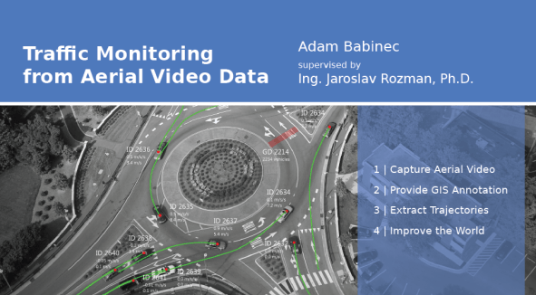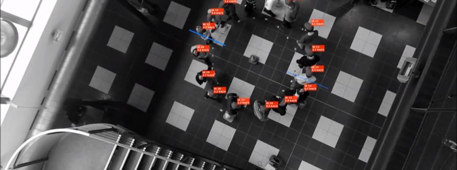
Researchers from Technical University of Brno recently had an interesting idea: Use a number of students to simulate a convoy with human drivers and measure the dynamics of that situation. To do so, they turned to DataFromSky, their trusted research partner.
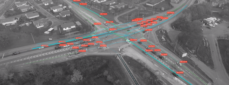
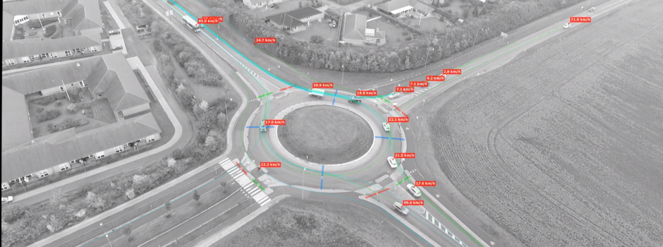
It is no coincidence that DFS turned out to be a great tool for such situation – our long-term vision is to be the tool for spatial movement analysis. The students’ positions were marked manually; the rest of needed processing was already part of our software.
Enough rambling, take a look!