TrafficSurvey – Video post-processing platform

Let's meet!
Intertraffic 2024
16 - 19 April 2024
Amsterdam / Netherlands
Traffex
22 - 23 May 2024
Coventry / England
Let's meet!
Intertraffic 2024
16 Apr -
19 Apr 2024
Amsterdam / Netherlands
Traffex
22 May -
23 May 2024
Coventry / England

Improving the traffic conditions in Brussel with DataFromSky

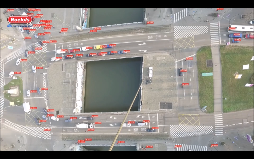
Our partner Roelofs has made an analysis with DataFromSky for a big junction in the city center of Brussel, Belgium. The analysis covers the junction between the Leopold II Lane and Sainctelette – one of the biggest and most complex junctions in Brussel. In this case, the video is made by a tethered drone to get a longer survey. Thanks to DataFromSky, it is possible to create a detailed traffic study which was handled to the government of Brussel and its Mobility department, providing the correct data for creating solutions that can improve the traffic flow and safety of this junction.

DataFromSky Aerial analysis is providing complete and detailed telemetry data about each traffic participant:

  • complete object trajectories (time, position, speed, acceleration in coordinate system UTM or WGS84) – visualization in program or various exports
  • classification of all objects into 7 main categories (including bicycles and pedestrians)
  • vehicle counts via configurable counting gates
  • detailed OD matrix and turning movements count in defined directions
  • speed and acceleration anywhere in the scene, heatmaps
  • lane assignment
  • measurement of critical headway (gap) and follow-up headway
  • safety analysis (Time to collision measurement, PET, Heavy breaking etc.)
  • and much more!
  • Do you want to use DataFromSky project in your project? Contact us with your query!